The top of Bali Pass is more summit like than a Mountain Pass
Our journey begins from Dehradun, making it a good option for people looking for treks near Delhi. Driving alongside the Tons river, and passing villages in Uttarakhand like Damta, Purola, Mori, and Netwar, we will reach the base camp Sankri. There is no network in this village, letting us take in the sight of the sun gloriously setting over the surrounding Greater Himalayan peaks without any distractions. We will be accommodated in hotels or homestays here.
After a hearty breakfast, we will be transported to Taluka by car. The motor able road in Govind Pashu National Park ends here. The trek commences on a stony path alongside the gushing river Supin. We also see plantations of the red-coloured Himalayan crop amaranth, locally known as cholai. Under the shade of walnut, pine, deodar and maple trees, the walk is as pleasant as the villagers greeting us on the way.
A few hours and crossing over a few streams later, we see the village of Gangad across the river on the left. We continue our hike and after about an hour, the quaint village of Osla unfolds itself. Osla is a household name among trekkers. Home to about 200 families, it gives us a peek into Garwahli culture. Seema is a tiny settlement opposite to Osla on the other side of the river. We set camp here or stay in a hut with a local family in the village.
Leaving the last of human settlements behind, we continue along the true left of the valley along the river Supin. Supin merges with Rupin near Netwar village to form Tons, which is the biggest tributary of river Yamuna.
An ascend through deodar trees leads us to a beautiful meadow – Devsu Thatch. This 1km expanse of green land is set against the looming Swargarohini ranges. We can also see Kalanag (Black Peak) (6387m) straight ahead. On our left, we can see Har Ki Dun Valley. At its bottom lies the confluence of Har Ki Dun and Ruinsara rivers.
After descending from the meadow, we enter the Ruinsara valley. At the end of today’s trek, we camp beside the stream close to the waterfall locally known as Roiltigad or Roiltia.
Today’s journey is going to take in under 2 hours even at a slow pace. And within this hike itself we notice a stark change in vegetation. Pine and fir trees give way to birch and rhododendron trees. The thick forest we trudge through is frequented by the endangered Himalayan brown bear. If we are very lucky, we might spot this rare and elusive creature.
We then reach one of the highlights of the trek — Ruinsara Tal, an alpine tarn, surrounded by lush Rhododendron trees, with their distinct pink bloom in the summers. We will be left enchanted by this sacred lake in the Uttarakhand Himalayas. It is one of the trio of lakes in the Garhwal region, the other two lakes being Marinda and Maldaru. We will be camping overnight near the lake.
Lying at an elevation of about 3500 m, Ruinsara lake is a good place to acclimatize ourselves before reaching Bali Pass base camp the next day.
Ruinsara Tal’s reputation precedes itself for its beauty. The small and pristine lake lies within a vast meadow, alpine vegetation and surrounding rhododendron bushes. There is innumerable variety of alpine flowers growing around the lake. The river Supin is situated 100 meters below the lake, next to a ridge.
It is the perfect place to play games with our trek mates, read a good book or just sit quietly to soak in nature’s tranquillity.
We can also spend the day exploring nearby places. One can trek towards the Banderpunch glacier or Kyarkoti which is the base camp for Kalanag and Dumdar Kandi pass.
We return to the camp in the evening.
We start the day early so as to reach our destination before afternoon. We descend down to the shallow river bed, cross over to the opposite bank and walk uphill to another beautiful meadow – Thanga. This meadow also offers awe-inspiring views of the seemingly omnipresent Swargarohini ranges. Kyarkoti valley lies towards the left.
We soon reach Odari. The word ‘Odari’ means a naturally made cave rock. This place has a mythological story associated with it. It is believed that Bali, Hanuman’s brother, had stayed here for one night. Here too we might find evidence of the rare Himalayan brown bear. We camp below Bali Pass along a glacial moraine. This is the one of the best locations for a camp, with the valley below and the Pass behind us. The temperatures at night tend to go to sub-zero degrees. Camping at this altitude is a unique experience which very few treks offer.
This day of crossing Bali Pass too begins very early. We strive to reach the summit by 8am. The trail heads down south, over a ridge. It is a fairly short but steep climb up to the Pass. A lot of glacial scree will be encountered here. Time taken to reach the top ranges from 45 minutes to one and a half hours.
Once we reach the top, we behold the Yamunotri valley for the first time. The view is breath- taking. We see hints of the Saptrishi Kund, which is the origin of river Yamuna. We also get to witness the Banderpunch peaks from the top of the Pass. The summits of Dayara Bugyal, Barua Top and Dokrani Bamak are visible too. We then descend carefully via a connecting ridge and reach the camping grounds of upper Dhamni.
We descend further to a forested trail. This path leads us to the famous shrine of Yamunotri with the glorious Bandarpunch in its background. One of the temples in the Char Dham circuit, it is dedicated to Goddess Yamuna. After paying obeisance to her black marble idol, we make our way down the conventional pilgrim road to Janki Chatti. We stay overnight in one of the guesthouses here. We will get electricity but no phone network.
This is the final day of the trip and we drive back to Dehradun. We can make the most of this jourey by visiting other well-known places that fall on this route such as Kempty waterfalls, Nainbagh and Mussourie.
With equally beautiful memories of an offbeat trek and touristy sight-seeing, we have a cherishable experience.
 Ruinsara Lake as seen from a distance
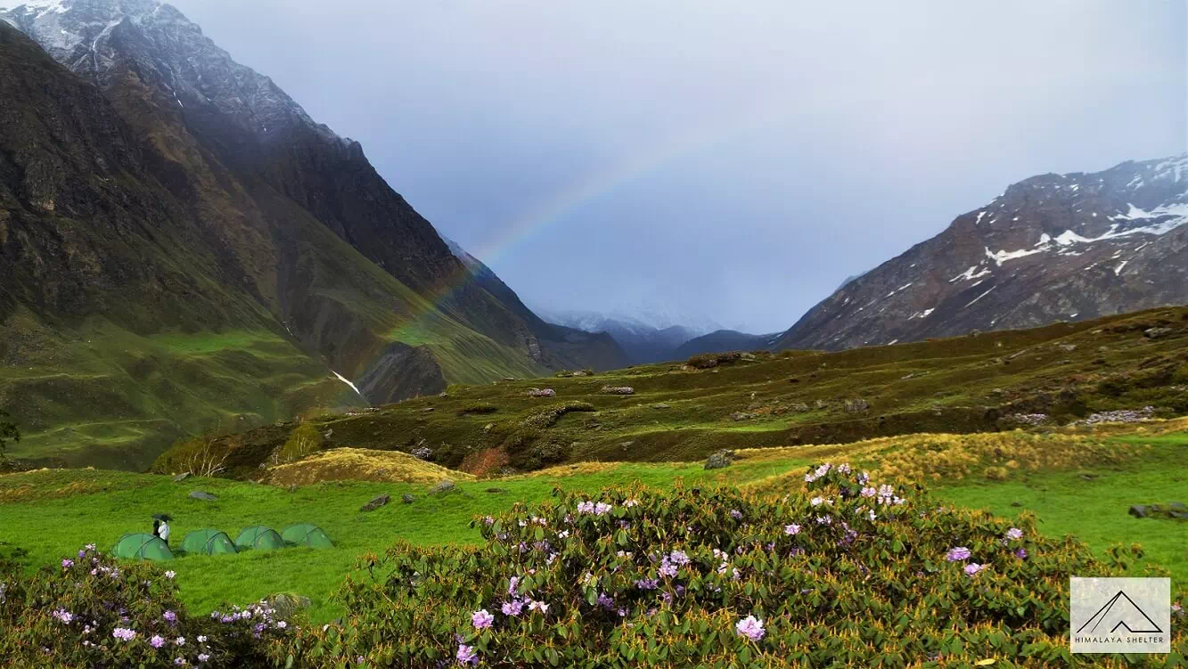 Rainbow at Thanga Campsite which can be substituted for Odari on Day 6
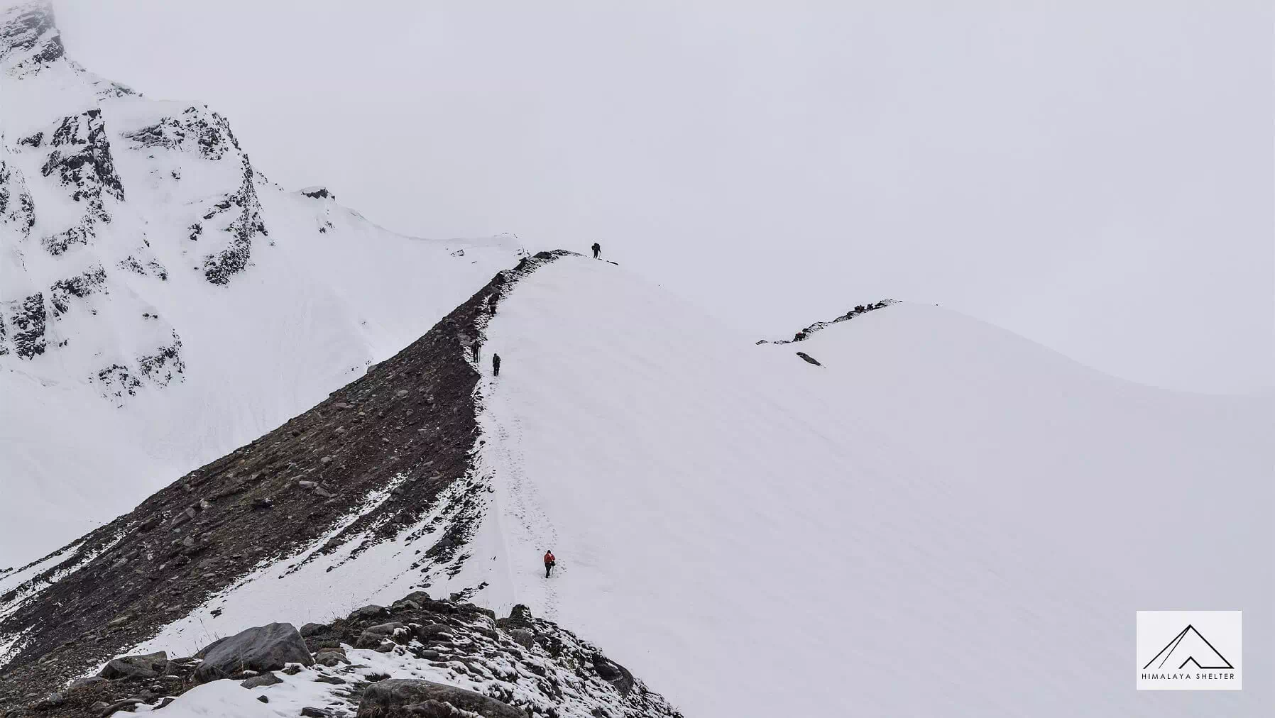
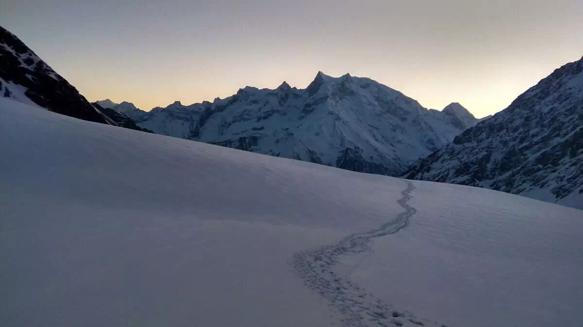
 The Bali Pass Ridge is a famous and perhaps the most iconic section of the trek with glacier on either side and a steep ridge running in between
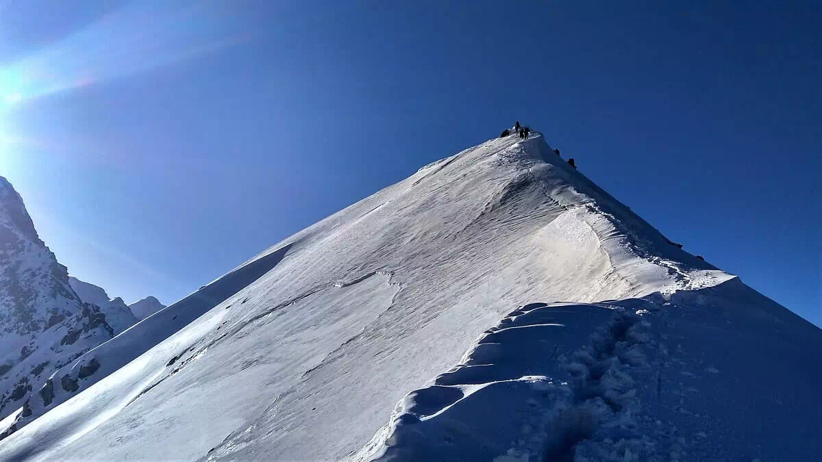
Bali Pass Ridge in Summers
The Bali Pass Ridge is a famous and perhaps the most iconic section of the trek with glacier on either side and a steep ridge running in between
Bali Pass Ridge in Summers
 Swargarohini Massif before sunrise from Basecamp
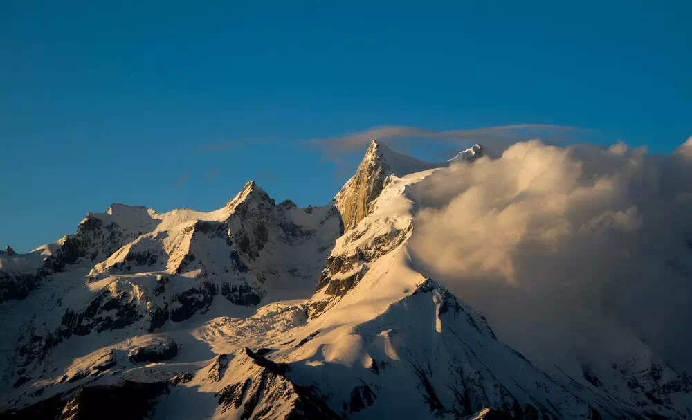 Clouds forming against the Swargarohini Massif during evening hours of a summer day
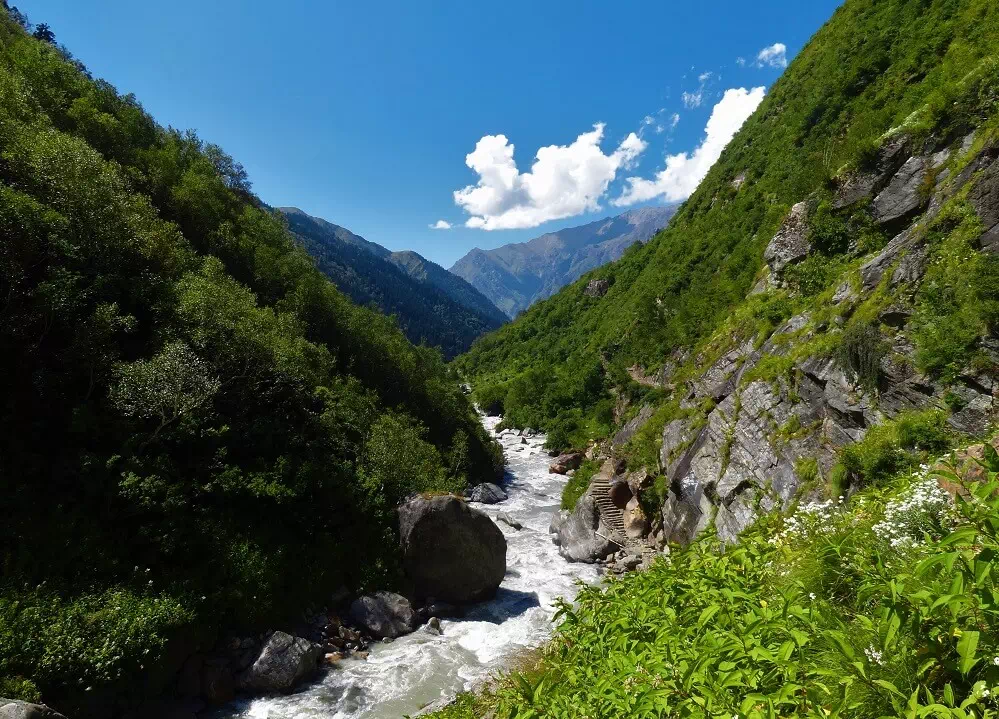 Beautiful lush trail to Ruinsara in September
Bali Pass is a difficult trek with high altitude of 4,900 meters or 16,076 feet.
The trek on at least 4 days of the total 7 trekking days can be long with more than 10 KM walks.
The ascent to Bali pass base camp from Odari is steep and covered in snow in the months of April-June. The last section is very steep requiring strenght and experience. The descent has some initially challenging and tricky sections which need to be carefully crossed. From Upper Damini the trail is well laid upto Yamunotri.
In summer months of May & June the weather is really pleasant, with warm sunny days. The trail receives good amount of sunlight with enough shade to rest in between. Evenings can be breezy and somewhat cold and will require you to use insualted clothing layer. Spells of rain can kick in anytime post noon. Ahead of Odari it can snow if the weather gets bad, as we are in high altitiude zone.
Weather is pleasant in the first three weeks of September , with the least amount of rain or snow in the entire year. The meadows are blooming post the monsoon and wild grass grows tall all the way upto Thanga, with scattered meadows around Odari. All the snow melts away the trail is mixed with boulders and sand all the way upto the Bali Pass. Snow starts late in September or Early October and the pass closes very quickly after the first few spells of snow.
Mountain Peaks such as Black Peak, Swargarohini Massif and Badnarpunch Massif are visible upclose.
Reviews
There are no reviews yet.