Rivers Of Uttarakhand
A brief list of Major Rivers across Uttarakhand
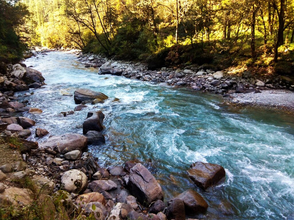
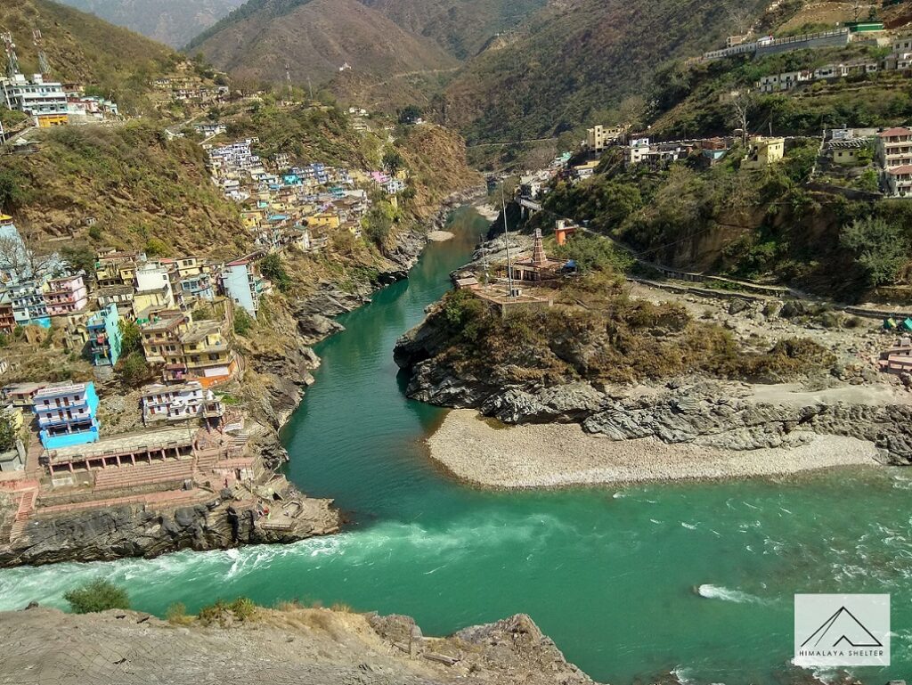
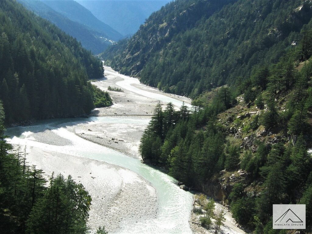
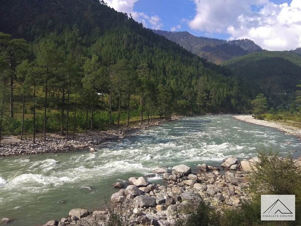
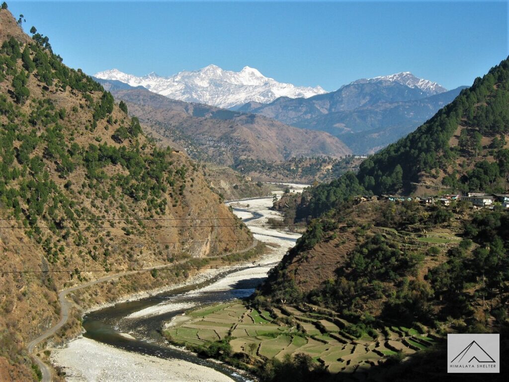
The land of gods, also commonly known as the Devbhoomi, Uttarakhand is an Indian state which is blessed with the ever-flowing iridescent rivers making the landscape undoubtably one of the most pristine in North India. Holy and sacred in nature, the rivers of Uttarakhand are largely considered auspicious and lively. It is believed that the rivers, originating from the glaciers of India, Tibet and Nepal are not only religiously significant but play an important role in the cultural, economic and environmental life of the state and its citizens. Uttarakhand minus the rivers would literally be non-existent! Considered as the backbone of the state, the rivers are used for a variety of purposes ranging from prayers to agriculture and even to carry out day to day chores. Catering to the ritual needs of the Hindu devotees, the rivers of Uttarakhand are also famous for forming Sangams i.e. the convergence of two rivers at a given point. These sangams are termed as Prayags and there are five main Prayags that render Uttarakhand’s importance as a religious and spiritual state! Highly relevant in the Hindu mythology, these rivers are till date worshipped. Each river has its own notable presence making its paramountcy consequential. The rivers are also a source of major hydro and irrigation project, having disastrous consequences on the ecosystem in particular and environment in general.
Here are a few major rivers flowing among the Indian Himalayas of Uttarakhand, starting from Tons in the west till Kali in the east!
1. Alaknanda
Originating from the Satopanth Glacier and the Bhagirathi Kharak Glacier, Alaknanda (a Himalayan river) is considered as the source stream of Ganga, alongside of Bhagirathi. The length of Alaknanda is 190 km, flowing through major towns of the Garwhal division; covering Chamoli, Rudraprayag and Pauri Garhwal districts. It meets Dhauliganga at Vishnuprayag, Nandakini at Nandprayag, Pindar at Karnaprayag, Mandakini in Rudraprayag and Bhagirathi in Devprayag; where is officially becomes Ganga. Alaknanda is considered to be one of the holiest rivers of the state as its cuts through the very famous town of Badrinath, the last destination of Char Dham yatra. Alaknanda River is also desired for its adventurous side as its white waters and ferocious rapids offers thrill of a life time. Currently, there are 6 operational hydel projects on Alaknanda and 8 are under construction.
2. Bhagirathi
Bhagirathi river originates from Gaumukh, the base of Gangotri and Khatling glaciers in Uttarakhand. Crossing Gangotri, a part of the Char Dham Yatra, Bhagirathi is considered holy as it is believed that the origins of it is highly regarded in the Hindu legends. Bhagirathi (meaning, ‘caused by Bhagiratha’) has been named after King Bhagiratha who meditated to bring Ganga on earth so that the sins of his forefathers could be washed away. It is joined by tributaries such as – Kedar Ganga, Jadh Ganga, Kakora Gad, Jalandari Gad, Siyan Gad, Asi Ganganear and Bhilangana. It flows past Kedarnath, where people make sure to take a dip so as to wash away their sins. The length of river is 205 km starting from an elevation of 3,892 metres. The confluence of Bhagirathi and Bhilangana is also the region where the very famous, yet controversial, Tehri dam was built (the highest dam of India completed in 2006).
3. Dhauliganga (Garwhal and Kumaon)
Dhauliganga is one of the six source streams of Ganga, flowing for 94 km, before meeting Alaknanda at Vishnuprayag. Dhauliganga of the Garwhal district emerges from Deovan Himani. It rises to an elevation of 5,070 metres at Niti pass in the Chamoli district. Tapovan, which is famous for hot springs, is also situated on the banks of Dhauliganga. There are three hydro projects that are to be set up on the Dhauliganga, all of them located in the Chamoli district: Lata Tapovan, Maleri Jhelum and Jhelum Tamak.
There is another Dhauliganga that transverses through the Kumaon division of Uttarakhand. Dhauliganga of this division is a tributary of Kali river. Its flows for 91 km before merging with Kali at Tawaghat. It emerges from Govan Khana Himani.
4. Ganga
Also known as Ganges, Ganga is considered one of the holiest rivers in the entire of India and world. It emerges from the confluence of Alaknanda and Bhagirathi and exits Uttarakhand at the plains of Haridwar. The 2,510 km river drains into the Sunderbans delta in the Bay of Bengal. Ganga is also a river full of stories. An important river in the mythology, capitals of many empires since ancient India have been built along its banks. Ganga also has been a symbol of divinity, spirituality, purity and salvation. In the Hindu mythology, it is worshipped as a goddess (the one who absorbs all the sins), thereby luring millions of pilgrims to its banks every year. Ganga is also known as Vishnupadi as the legends hold that Ganga emerged from the feet of Lord Vishnu. Besides bathing to wash away sins, it is also used for cremation purposes. The very famous Kumbh Mela is also held along its banks. Ganga originates from various glaciers- Satopanth, Khatling and the peaks of Kedarnath, Kamet, Nanda Devi, Nanda Kot and Trishul. Ganga also comprises of many streams, top 6 being- Alaknanda, Bhagirathi, Mandakini, Dhauliganga and Pindar and Nandakini. There are various hydel projects situated on the river; including canals, dams and barrages. The length of Ganga in Uttarakhand is 96km.
5. Gori and Kali Ganga
Gori Ganga, also known as Ghori Ganga, originates from the Milam glacier; flows for 104 km before merging with Kali ganga in Jauljibi. It flows from the eastern wall of the Nanda Devi sanctuary and runs through the district of Pithoragarh. Kali ganga flows from Lipmpiya Dhura at an elevation of 3,600 meters and ends in Uttar Pradesh after merging into the Ghagra river. It is also joined by the Dhauliganga river at Tawaghat. Kali ganga becomes Sharda river when it enters the plains at Tanakpur. It attracts rafters from all over India as it is blessed with level 4 of white-water rapids!
6. Mandakini and Nandakini
Emerging from the Chorabari glacier near Kedarnath Mandakini drains into Alaknanda in Rudraprayag. Before this, it merges with Kali ganga near Kalimath temple and Madhyamaheswar ganga near Ukhimath. It mainly flows through the Garhwal district of the state. The river is pious and holy as is it mentioned in Bhagwat Geeta, a Hindu scripture. The name usually signifies ‘the river of the air or heaven’. Passing by Kedarnath, it is worshipped by millions of pilgrims thereby offering spiritual deeds to all! It only flows for 72 km but is very ferocious and turn extremely violent during the monsoons engulfing the villages and roads in its proximity. Mandakini is the river responsible for the Kedarnath floods of 2013, that led to huge destruction of life, property and environment. It is also preferred by rafters as they get to enjoy the adventurous side of the river with Grade IV and V white water rapids.
Nandakini originates from Nanda Ghughati, within the Nanda Devi wildlife sanctuary. The river flows for 56 km before merging with Alaknanda at Nandaprayag. Mostly calm, Nandakini flows through the Garwhal district.
7. Pindar
Emerging from the Pindari glacier from the Bagheshwar district of Uttarakhand, Pindar river is also known as Pindari river. It flows for 105 km crossing small towns like Manmatti, Dewalo, Bhagori and Nauti. It finally merges with Alaknanda at Karnaprayag.
8. Ramganga (Western and Eastern)
The western Ramganga river originates from the Dhudhatoli ranges in the Pauri Garhwal district of Uttarakhand. It flows for 155 km and cuts between the Jim Corbett national park before entering the plains. In Uttarakhand it passes through Taal, Bhagoti and Masi in the Kumaon division. It feeds to the cities of Moradabad, Bareilly and Shahjahanpur in Uttar Pradesh and joins Ganga near Kanauj in the Fatehgarh district. Ramganga is also known for its dam, Ramganga Dam (also known as Kalagarh dam), built in the district it originates from.
The source of the eastern Ramganga is the Namik glacier, which is situated in the south-east of the Nandakot peak. It flows for 108 km in the Kumaon region before merging with Saryu river at Rameshwar. Rendering land near its bank very fertile, eastern Ramganga flows through the towns of DIdihat, Gangolghati, and Narayan Ashram.
9. Saryu
A Himalayan river flowing through the Kumaon region, Saryu (also known as Sarju) originates from Sarmool. It flows for 146 km before merging with Mahakali river at Pancheshwar. At Bageshwar, it meets the Gomti river. The confluence of these two rivers is famous for being dotted with Bagnath temple. Sodhra, Gwara, Song, Kapkot and Rameshwar are few towns located at the bank of Saryu. Bhuni, Sup and Khati are the famous ghats of this river.
10. Tons
One of the prime Himalayan rivers, Tons emerges from the meltwaters of the Banderpoonch mountain. It is the largest tributary of Yamuna flowing for 148 km before merging with the same near Dehradun, at Dak Pathar. It has a heavier flow than Yamuna itself. The source of Tons river comes mainly from the convergence of the Rupin and supin rivers in Himachal Pradesh and Har Ki Dun valley respectively at a small hamlet known as Naitwar. Tons flows through the villages of Sankri, Mori, Mahasu and Hanol. Its two main tributaries are the Pabbar and Asan rivers. The mythical origin of the Tons River is related, through a legend, with Mori. Mori is located on the banks of Tons River in the Uttarkashi district of Uttarakhand. People of Mori are followers of Kauravas. It is believed that when Pandavas defeated the Kauravas, the people of the valley cried and cried and hence Tons River is a creation of their unstoppable tears. Tons is also highly regarded for its flow making it an ideal destination for rafters!
11. Yamuna
Just as important as Ganga in the Hindu mythology, Yamuna is a highly renowned river in Northern India. Originating from the Yamunotri glacier at an elevation of 6,387 metres, Yamuna flows through thw Lower Himalayas and Shivalik ranges before entering the plains. Yamunotri is also a part of the Char Dham yatra. It exits Uttarakhand at Dhalipur after flowing through the Garhwal region. Tons is the largest tributary of Yamuna, flowing from the feet of Har Ki Dun valley. Yamuna is the longest tributary of India and second longest of Ganga before meeting the same at the Triveni Sangam. Triveni Sangam is the confluence of Ganga, Yamuna and the Invisible Saraswati river at Allahabad. The confluence is also the site of the Khumb Mela, that takes place every 12 years. Yamuna has many legends attached to it making it a significant river in the lives of millions of Indians. In Hindu mythology, Yamuna is the daughter of Sun God, Surya, and sister of Yama, the God of Death, hence also known as Yami and according to popular legends, bathing in the sacred waters frees one from the torments of death. Flowing for 1,376 km, Yamuna is not only important for religious purposes but also others. It is used for irrigation activities all over north India. However, in the recent times, the condition of Yamuna has worsened. With huge amounts of pollutants being released into it daily, Yamuna has become one of the most polluted rivers in the world. Too tackle this, the government has launched various projects to save Yamuna. However due to lack of effective implementation, the condition remains the same.
Related Blogs
September 10, 2021
Why Is Hydration Important during Himalayan Treks?
Importance of Hydration during trekking in the Himalayas.
Read more
September 10, 2021
What Makes Mussoorie The Queen Of Hills?
When to visit Mussoorie, top attractions and things to do in Mussoorie! How to reach and more information...
Read more
September 7, 2021
VILLAGES OF HAR KI DUN
Har ki Dun, which means valley of Gods, is a cradle shaped valley situated deep inside Uttarkashi district of Uttarakhand. Find out more...
Read moreSeptember 4, 2021
Valley of Flowers and Hemkund Sahib
A day wise visual blog from Valley of Flowers & Hemkund Sahib trek...
Read more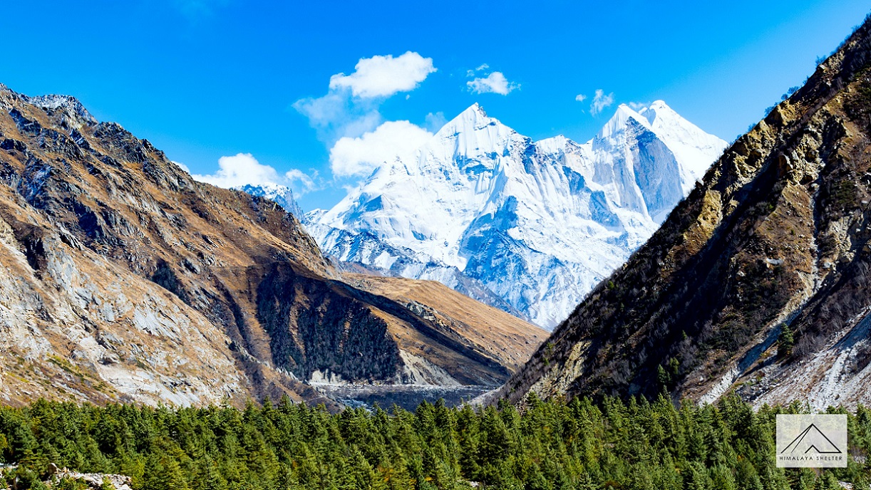
September 8, 2021
Uttarakhand - Your all year adventure destination
The “Land of Gods” is blessed with five distinct seasons. Read the blog to find out about Uttarakhand's all year adventures...
Read more
September 8, 2021
Trek to Satopanth Tal: A high altitude alpine lake
The sight of a lake being hugged by mountains was unimaginably captivating. Read the blog to find out about trek to Satopanth...
Read more
September 8, 2021
Top 5 Winter Treks in Uttarakhand
Winter trekking in the Himalayas is worth a try if you have never done it. Read the blog to find the top winter treks in Uttarakhand...
Read more
September 8, 2021
Top 10 Offbeat Treks of Uttarakhand & Himachal
Choosing a less popular trek offers you that solitude you seek and it also gives you a tale to talk about. Find out about treks less explored.
Read more
September 4, 2021
Top 10 Applications for Trekking
List of Mobile Applications based on Android/Apple Platforms to assist you during trekking in the Himalayas
Read more