Peaks Of Uttarakhand
A brief list of Mountain Peaks across Uttarakhand
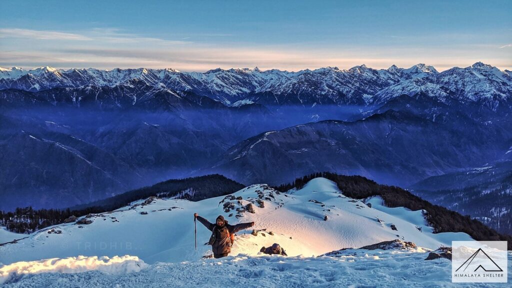
In my opinion there are two types of people in the outdoorsy world. There is one who aims to climb every mountain, catch a bird’s eye view of the world and claim the summit. Then there are the others who trek far and wide to just be in the presence of these majestic mountains and be awestruck. I am the latter one who plans every outdoor adventure with a mountain and not the mountain top in mind.
The state of Uttarakhand boasts of two of the top three mountains in India, both seven-thousanders, which lie in the Greater Himalaya mountain range. The rugged terrain of the Indian Himalayas of Garhwal and Kumaon division in the state can be broadly classified into mountain ranges of Bandarpunch, Gangotri, Kamet, Nanda Devi, Panchchuli, and Adi Kailash.
At the western edge of high Himalayas in Uttarkashi district is the Bandarpunch range of mountains. The notable six-thousanders are:
Bandarpunch group| 6,316 meters
This three-peak massif of Bandarpunch I (Saraswati Devi Parvat), Bandarpunch II or White Peak (Hanuman Parvat) and Black Peak (Kalanag) is located in the Govind Pashu Vihar National Park and Sanctuary. Black Peak is the highest peak in the range. The Yamunotri glacier lies on the west end of the massif which is the source of the river of its namesake. It is believed that the name of the mountain derives from the tale of Lord Hanuman summiting the mountain to extinguish his tail which was set on fire in the court of Ravana in Lanka.
The trek of Dayara Bugyal offers captivating view of this mountain on reaching the meadows. Trek to Ruinsara lake and Bali pass gives you a fantastic opportunity to admire the Black Peak (Kalanag) in all its glory.
Swargarohini | 6,252 meters
This three peak massif takes its name from the legend which identifies it as the “stairway to heaven”. It is presumed that when the Pandavas renounced the world they scaled the mountain. Only Yudhisthira and a dog who was none other than Lord Yama, made their way to heaven retaining their bodies.
The trek to Har Ki Dun offers enchanting views of Mt. Swargarohini along with Jaundhar Glacier which will leave you speechless.
Moving towards the east is the striking Gangotri range of mountains. They are spread across from Uttarkashi to Chamoli district with presence in Rudraprayag and Tehri Garhwal too. Several peaks are home to the Gangotri Glacier which is the primary source of India’s lifeline, the river Ganga. Home to three of the Char Dhams, these are undoubtedly the holiest mountains in India.
The most pronounced mountains of this range are:
Chaukhamba | 7,138 meters.
This four-pillar massif is the highest peak of the Gangotri range with the Gangotri glacier situated on its western slope. Spread across Uttarkashi-Chamoli and Rudraprayag districts, its spectacular view is seen on Deorital-Chopta-Chandrashilla trek.
Satopanth | 7,075 meters
The second highest peak in the range derives it name from the amalgamation of two Sanskrit words, “Sato” i.e. truth and “Panth” i.e. a spiritual path. Its altitude and technical challenges offer a perfect training ground for pre-Everest expedition.
Kedarnath | 6,940 meters
It is considered to be the highest peak on the south side of the Gangotri Glacier with Kedarnath Dome as the third highest.
The Kedarnath temple, one of the Char Dhams is situated just 7 km away.
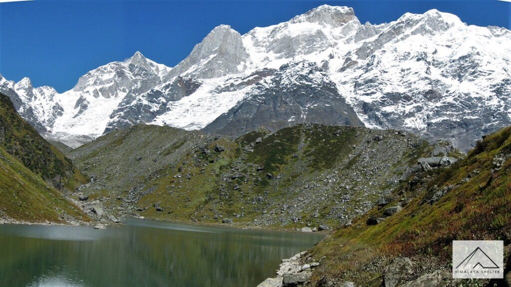
Thalay Sagar | 6,904 meters
It is the second highest peak on the south side of the Gangotri Glacier. Situated around 10 km from the Gangotri Glacier, it stands as the most dramatic rock peak with lake, Kedartal at its base.
Trek up to this emerald blue lake to enjoy the most enchanting views of Mt.Thalay Sagar with Mt. Bhrigupanth (6,772 m) in tow.
Bhagirathi | 6,856 meters
This three-peak massif, also known as Bhagirathi Sisters, is walled by glaciers on all sides. On the eastern side of the massif is Vasuki Glacier while on the western side is the Gangotri Glacier. On the northern side it is flanked by Chaturangi Glacier and southern side by Swachhhand Glacier.
Located in the protected Gangotri National Park, one can embark on various treks to relish the views of this glorious mountain. Multiday treks of Gaumukh Tapovan and Vasuki tal are the best options.
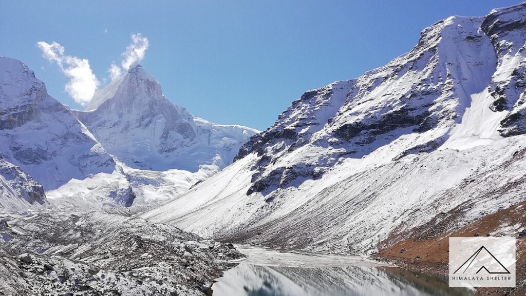
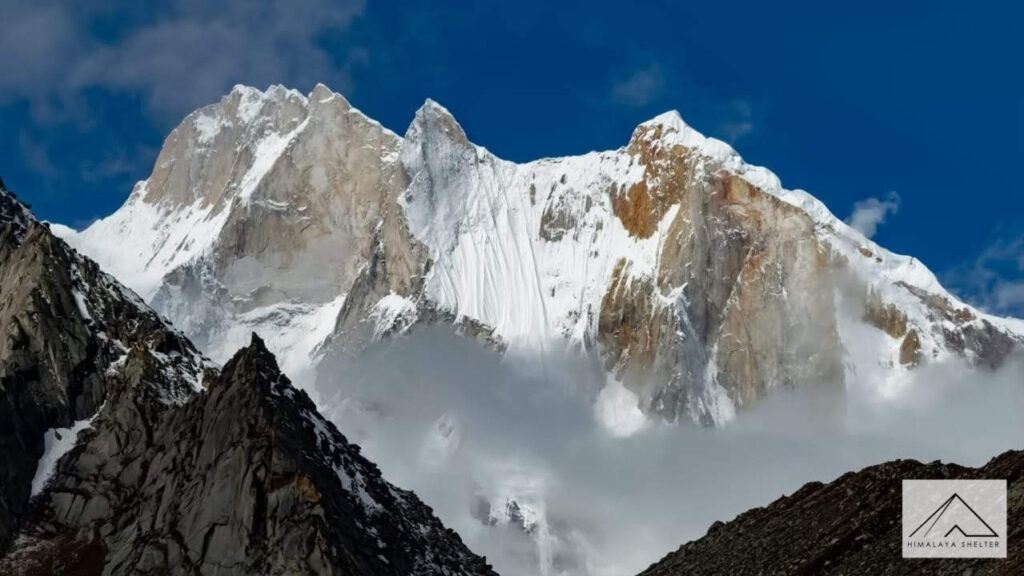
Shivling | 6,543 meters
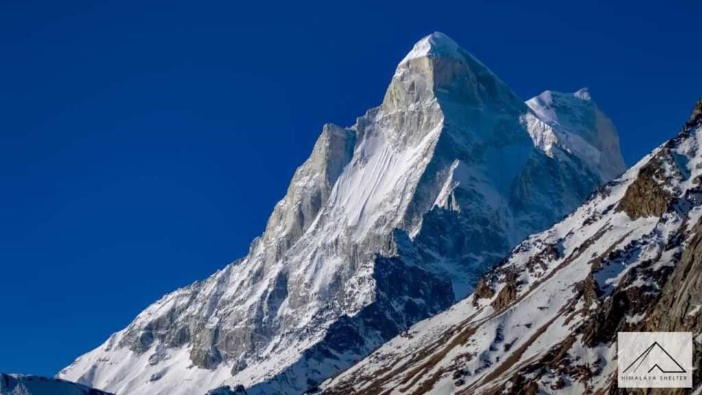
The “Matterhorn” of India, located in Tapovan near the snout of Gangotri Glacier is a magnificent mountain in the Gangotri range. With two summits it rises like a pyramid resembling a lingam.
The sunset view of Shivling on the Gaumukh-Tapovan trek would leave you absolutely spell bounded.
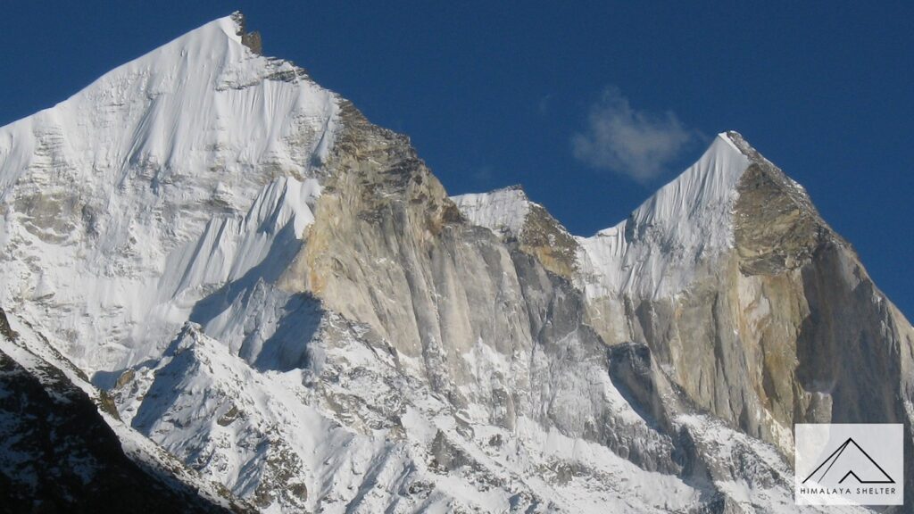
Meru | 6,660 meters
Mt.Meru is flanked on two sides by Mt. Thalay Sagar and Mt. Shivling. Meru is a Sanskrit word which means spine. The mountain is aptly named cause of the shape of the mountain. The three peaks of the mountain with central Shark Fin is considered one of the hardest climbs in mountaineering.
The trek to Gaumukh-Tapovan offers stunning view of Mt. Meru along with Mt.Shivling and Bhagirathi Sisters.
Nilkantha | 6,500 meters
One can enjoy the dramatic view of this peak behind the holy temple of Badrinath, one of the Char Dhams.
In the Chamoli district of Uttarakhand are the less talked about Kamet range of mountains. They are impressively taller than the Gangotri range and are remote, bordering the Tibetan plateau.
Kamet | 7,756 meters
It is the second highest peak in Uttarakhand resembling a pyramid with a flattened top. Interestingly after a successful scaling this mountain, Frank Smythe, Eric Shipton, R.L. Holdsworth and Lewa Sherpa, members of a British expedition team, stumbled upon the Valley of Flowers, now a famous monsoon trek.
Neighbouring peaks of Abi Gamin (7,355m), Mana Peak (7,272m) and Mukut Parbat (7,242m) are the 4th, 5th and 6th highest peaks of Uttarakhand respectively. Hathi Parbat (6,727 m) in the Kamet range of mountains is also known as Elephant peak due to its obvious resemblance. A neighbouring peak which resembles a horse back is called as Ghoda (6,708 m) and is always spoken about in the same breath.
As we travel further east in Chamoli district, the Nanda Devi mountain range stands tall and mighty.
Nanda Devi | 7,816 meters
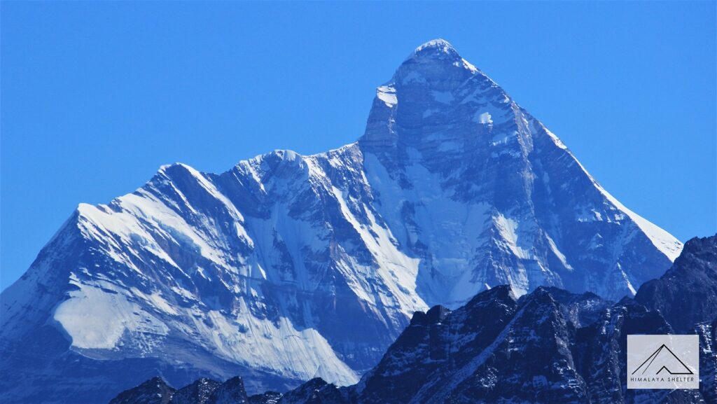
A two peak massif, it is the second highest mountain in India, second to Kanchanjunga and first highest mountain located in India in its entirety. The two peaks referred to as Nanda and Sunanada mean a “bliss-giving goddess”. As a respect to the mountain and the surrounding habitat, in 1983 it was deemed closed to all climbers. The delicate ecosystem neighbouring the peak with the mountain at the core forms the Nanda Devi Biosphere, which includes Nanda Devi National Park, now a UNESCO World Heritage Site. Its large and steep ascent from the surrounding terrain makes it comparable to scaling K2, the second highest mountain in the world. The Nanda Devi Sanctuary in the National Park is divided into inner and outer rings.
Trisul (7,120 m) along with some of the notable mountains like Dunagiri (7,066 m), Rishi Pahar (6,992 m), Kalanka (6,931 m), Changabang (6,864 m) form the outer wall of the sanctuary.
Tirsuli (7,074 m), Nanda Khot (6,861 m), Nanda Ghunti (6,309 m) along with Hardeol (7,151 m) are connected to the outer wall of the sanctuary with high passes.
Trisul | 7,120 meters
Like Lord Shiva’s trident, it is an extraordinary three peak massif which is also the ninth highest mountain in Uttarakhand.
You will find Trisul and Nanda Ghunti as constant companions on Roopkund trek.
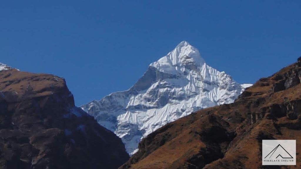
Panchachuli | 6,904 meters
As the name suggests, it is a peculiar five peak snow-clad massif in the Kumaon region of Uttarakhand. It is the 24th highest mountain in Uttarakhand. As the legend goes the Panch Pandav cooked their last meal here on a chulha before they left for the path of liberation.
Adi Kailash| 5,945 meters
This mountain located in the Pithoragarh district of Uttarakhand, has striking resemblance to Mount Kailash in Tibet. Hence it is also called as Chota Kailash. It is located near Brahma Parbat (6,321m) in the Adi Kailash range of mountains.
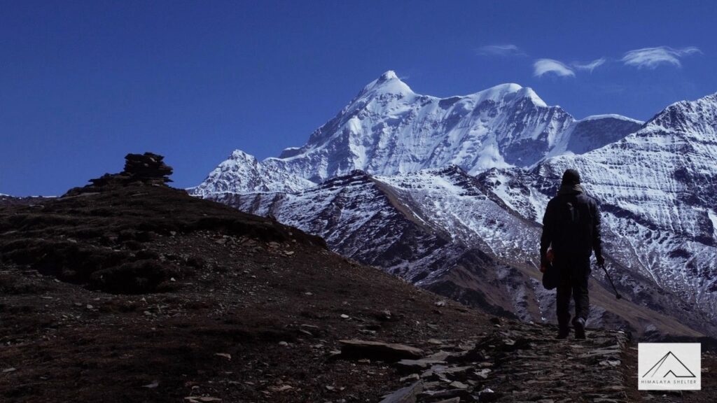
So, the next time you step out on the trekking trails in Uttarakhand, be prepared to blow your minds with some jaw dropping 180° panoramas. Go chase your mountain!
Related Blogs
September 10, 2021
Why Is Hydration Important during Himalayan Treks?
Importance of Hydration during trekking in the Himalayas.
Read more
September 10, 2021
What Makes Mussoorie The Queen Of Hills?
When to visit Mussoorie, top attractions and things to do in Mussoorie! How to reach and more information...
Read more
September 7, 2021
VILLAGES OF HAR KI DUN
Har ki Dun, which means valley of Gods, is a cradle shaped valley situated deep inside Uttarkashi district of Uttarakhand. Find out more...
Read moreSeptember 4, 2021
Valley of Flowers and Hemkund Sahib
A day wise visual blog from Valley of Flowers & Hemkund Sahib trek...
Read more
September 8, 2021
Uttarakhand - Your all year adventure destination
The “Land of Gods” is blessed with five distinct seasons. Read the blog to find out about Uttarakhand's all year adventures...
Read more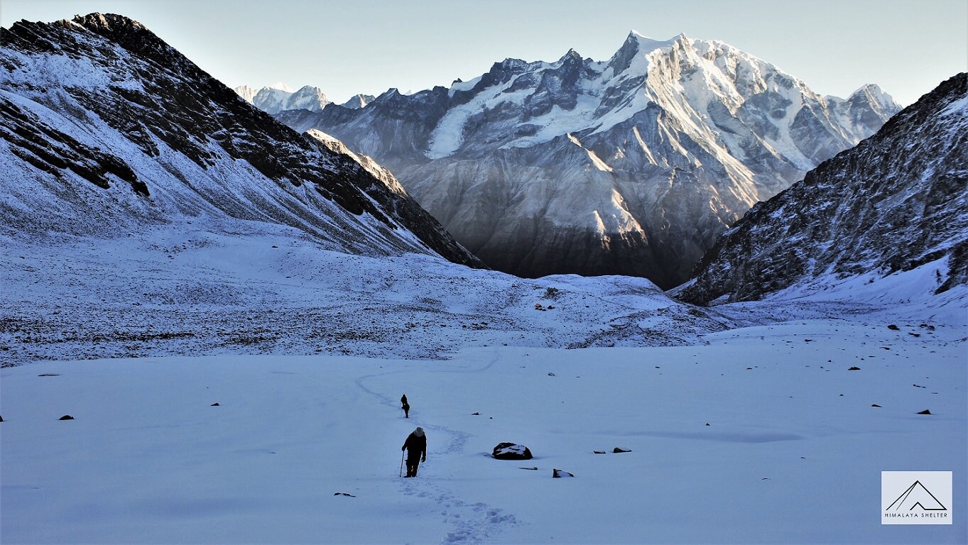
September 8, 2021
Trek to Satopanth Tal: A high altitude alpine lake
The sight of a lake being hugged by mountains was unimaginably captivating. Read the blog to find out about trek to Satopanth...
Read more
September 8, 2021
Top 5 Winter Treks in Uttarakhand
Winter trekking in the Himalayas is worth a try if you have never done it. Read the blog to find the top winter treks in Uttarakhand...
Read more
September 8, 2021
Top 10 Offbeat Treks of Uttarakhand & Himachal
Choosing a less popular trek offers you that solitude you seek and it also gives you a tale to talk about. Find out about treks less explored.
Read more
September 4, 2021
Top 10 Applications for Trekking
List of Mobile Applications based on Android/Apple Platforms to assist you during trekking in the Himalayas
Read more